The following conventions apply to facilitate the coordination of science planning, expedite the exchange of data between different instrument teams, and enhance the overall science activities.
The SOHO On Board Time (OBT) will use the CCSDS format, level 1 (TAI
reference, 1958 January 1 epoch), as discussed in section 3.3.9 of the
SOHO Experiment Interface Document Part A (Issue 1). The SOHO OBT is
an unsegmented time code with a basic time equal to 1 second and a
value representing the number of seconds from 1 January 1958 based on
International Atomic Time. The OBT Pulse is adjusted to maintain the
OBT within  20ms of the ground TAI.
The SOHO OBT is used to time tag the data packets sent to the
EOF and to the Data Distribution Facility (DDF).
The time tags for the spacecraft and instrument housekeeping packets
are generated by the spacecraft on-board data handling system. The time
tags for the instrument science data packets are inserted by the
instruments generating the science data. The time tags will be provided
in 6 bytes; the first 4 bytes are TAI seconds (2 to 2
to 2 seconds)
and the last 2 bytes are fractions of a second with the resolution of the
On Board Time Pulse (2
seconds)
and the last 2 bytes are fractions of a second with the resolution of the
On Board Time Pulse (2 seconds).
The SOHO Daily Pulse is generated every 86,400 seconds, and is
synchronized to the TAI with an accuracy better than  100ms.
The Daily Pulse will
correspond to the beginning of a TAI ``day'', that is the Daily
Pulse will occur at the zeros of TAI modulo 86,400. As of 1 January
1993, the difference between TAI midnight and 00:00 UTC was 27 seconds.
Since July 1
100ms.
The Daily Pulse will
correspond to the beginning of a TAI ``day'', that is the Daily
Pulse will occur at the zeros of TAI modulo 86,400. As of 1 January
1993, the difference between TAI midnight and 00:00 UTC was 27 seconds.
Since July 1 1993 UTC-TAI = --28sec (TBC).
The helioseismology experiments plan to center one minute observations on the TAI minute, that is where TAI modulo 60 is zero.
Coordinated Universal Time (UTC) will be used as the operational time reference in the Experiment Operations Facility. The ``SOHO operations day'' is defined to begin at 00:00 UTC and the computer systems in the SMOCC and EOF will be synchronized to run on UTC.
The solar rotation axis will be calculated using the
Carrington ephemeris elements. These elements define the inclination of
the solar equator to the ecliptic as 7.25 degrees, and the longitude of
the ascending node of the solar equator on the ecliptic as
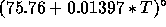 , where T is the time in years from J2000.0.
The solar rotation axis used for alignment of the SOHO
spacecraft will be determined from the Carrington ephemeris elements. The
Experiment Interface Document Part A (Issue 1, Rev 3) lists the
longitude of the ascending node of the solar equator as 75.62 and the position of the pole of the solar equator in celestial
coordinates as 286.11
and the position of the pole of the solar equator in celestial
coordinates as 286.11 right ascension and 63.85
 declination. This definition is consistent with a solar rotation axis
determined from the Carrington elements for a date of 1 January 1990.
As mentioned in the EID Part A, this information must be updated for
the actual launch date.
declination. This definition is consistent with a solar rotation axis
determined from the Carrington elements for a date of 1 January 1990.
As mentioned in the EID Part A, this information must be updated for
the actual launch date.
Heliographic longitudes on the surface of the Sun are measured from the
ascending node of the solar equator on the ecliptic on 1 January 1854,
Greenwich mean noon, and are reckoned from 0 to 360 in the
direction of rotation. Carrington rotations are reckoned from 9
November 1853, 00:00 UT with a mean sidereal period of 25.38 days, and
are designated as CR
in the
direction of rotation. Carrington rotations are reckoned from 9
November 1853, 00:00 UT with a mean sidereal period of 25.38 days, and
are designated as CR etc..
etc..
The spacecraft optical axes are defined with respect to the optical alignment
cube of the Fine Pointing Sun Sensor, with the optical X axis (X ) nominally
perpendicular to the spacecraft launcher separation plane and pointing from the
separation ring through the spacecraft. The spacecraft optical Y axis (Y
) nominally
perpendicular to the spacecraft launcher separation plane and pointing from the
separation ring through the spacecraft. The spacecraft optical Y axis (Y ) is
along the direction of the solar panel extension with positive Y
) is
along the direction of the solar panel extension with positive Y pointing
from the interior of the spacecraft towards the UVCS instrument.
pointing
from the interior of the spacecraft towards the UVCS instrument.
The orientation of the SOHO spacecraft is planned to have the spacecraft
optical X axis (X ) pointing towards the photometric center of the Sun, and
the spacecraft optical Z axis (Z
) pointing towards the photometric center of the Sun, and
the spacecraft optical Z axis (Z ) oriented towards the north ecliptic
hemisphere such that the (X
) oriented towards the north ecliptic
hemisphere such that the (X ,Z
,Z ) plane contains the Sun axis of rotation.
As such the Y
) plane contains the Sun axis of rotation.
As such the Y axis will be parallel to the solar equatorial plane
pointing towards the east (opposite to the solar rotation direction).
ESA will be responsible for achieving this orientation with the misalignment
margins defined in the EID-A.
axis will be parallel to the solar equatorial plane
pointing towards the east (opposite to the solar rotation direction).
ESA will be responsible for achieving this orientation with the misalignment
margins defined in the EID-A.
A standard coordinate system is required for joint observations between
instruments on the ground (for test purposes) and in space.
This system, designated (X ,Y
,Y ), will be defined as follows:
On the ground, the Y
), will be defined as follows:
On the ground, the Y axis is parallel to the spacecraft Z
 axis
and the X
axis
and the X axis is anti-parallel to the spacecraft Y
 axis.
In space, the (Y
axis.
In space, the (Y ,Z
,Z ) system is however no longer accessible. We will therefore
define a virtual system (Y
) system is however no longer accessible. We will therefore
define a virtual system (Y ,Z
,Z ), which is nominally coincident with
(Y
), which is nominally coincident with
(Y ,Z
,Z ) and where Y
 is perfectly aligned with the
solar equator and its origin is at the Sun centre, and define (X
is perfectly aligned with the
solar equator and its origin is at the Sun centre, and define (X ,Y
,Y ) in space as above using
the virtual system (Y
) in space as above using
the virtual system (Y ,Z
,Z ).
).
The inter-instrument flag system (X ,Y
,Y ) thus has
its origin at the Sun
centre, its Y
) thus has
its origin at the Sun
centre, its Y axis is in the plane containing the solar rotation axis
pointing north, and its X
axis is in the plane containing the solar rotation axis
pointing north, and its X axis positive towards the west limb.
Each instrument participating in the flag exchange is reponsible
for determining its orientation with respect to the (X
axis positive towards the west limb.
Each instrument participating in the flag exchange is reponsible
for determining its orientation with respect to the (X ,Y
,Y ) system
and report the coordinates of their observations in (X
) system
and report the coordinates of their observations in (X ,Y
,Y )
coordinates in units of 2 arcsec.
Off-limb observations need special treatment if X
)
coordinates in units of 2 arcsec.
Off-limb observations need special treatment if X , Y
, Y >1022''.
The Orbit data will describe the position and motion of the spacecraft, and it will be available in several coordinate systems including: geocentric inertial (GCI) coordinates for the J2000 system; geocentric solar ecliptic (GSE); geocentric solar magnetospheric (GSM) coordinates; and Heliocentric Ecliptic coordinate system.
The GSE coordinate system is defined as follows: The origin is Earth centered, with the X axis pointing from the center of the Earth to the center of the Sun; the Y axis lies in the ecliptic plane and points in the opposite direction of the Earth's orbital motion; the Z axis completes a right-handed orthogonal coordinate system and is parallel to the ecliptic pole. The Sun position is the true ``instantaneous'' position rather than the ``apparent'' (light-time delayed or aberrated) position. The ecliptic is the true ecliptic of date.
The Heliocentric Ecliptic coordinate system is defined as follows: the origin is Sun centered, with the Z axis parallel to the ecliptic pole with positive north of the ecliptic plane; the X-Y plane lies in the ecliptic plane and the X axis points towards the first point of Aries; the Y axis completes a right-handed orthogonal coordinate system.
The GCI coordinate system is defined as follows: Earth centered, where the X axis points from the Earth towards the first point of Aries (the position of the Sun at the vernal equinox). This direction is the intersection of the Earth's equatorial plane and the ecliptic plane --- thus the X axis lies in both planes. The Z axis is parallel to the rotation axis of the Earth and the Y axis completes a right-handed orthogonal coordinate system. As mentioned above, the X axis is the direction of the mean vernal equinox of J2000. The Z axis is also defined as being normal to the mean Earth equator of J2000.
The GSM coordinate system is defined as follows: again this system is Earth centered and has its X axis pointing from the Earth towards the Sun. The positive Z axis is perpendicular to the X axis and paralle to the projection of the negative dipole moment on a plane perpendicular to the X axis (the northern magnetic pole is in the same hemisphere as the tail of the magnetic moment vector). Again this is a right-handed orthogonal coordinate system.